241
TANNER, HENRY S. United State of America. Philadelphia: H.S. Tanner, 1832.

Das Auktionshaus hat für dieses Los keine Ergebnisse veröffentlicht
Marlborough, Massachusetts
Beschreibung
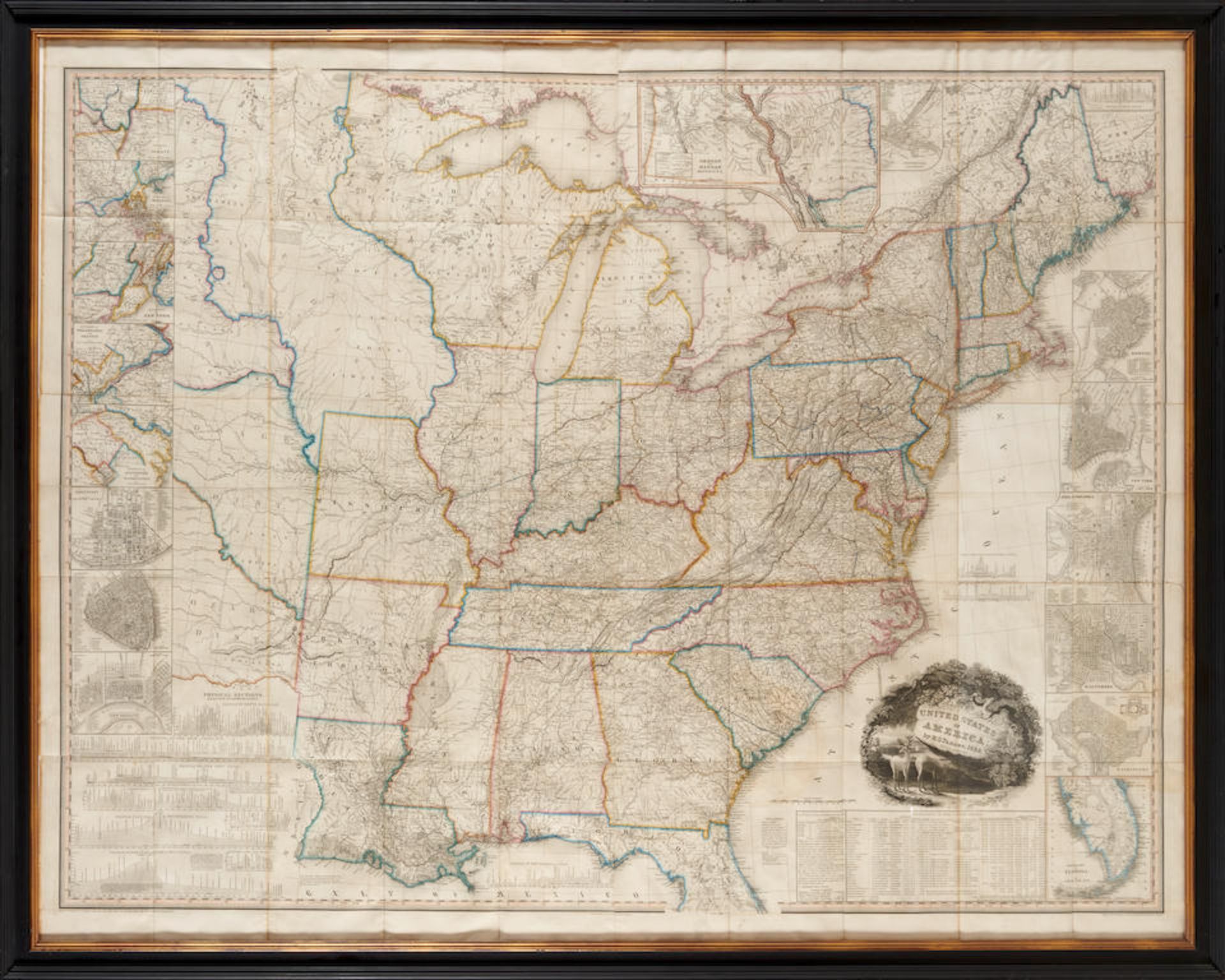
TANNER, HENRY S. United State of America. Philadelphia: H.S. Tanner, 1832. Engraved map, approximately 61,8 x 48,4 in, with hand-colored territorial boundaries, previously folded, browning to edges, some wear at fold creases with minor chipping. Framed. Not examined out of frame. Third edition, revised from the editions of 1829 and 1830. Schwartz and Ehrenberg, The Mapping of America 253; Phillips America 885; Rumsey, 4406. Footnotes: Provenance The collection of Eric van Rooy. Arader Galleries, New York, New York, 9 November 2002. For further information on this lot please visit Bonhams.com For further information about this lot please visit the lot listing
Auktionsdetails
Versand
AGB & Wichtige Informationen
Stellen Sie dem Verkäufer eine Frage
TANNER, HENRY S. United State of America. Philadelphia: H.S. Tanner, 1832. Engraved map, approximately 61,8 x 48,4 in, with hand-colored territorial boundaries, previously folded, browning to edges, some wear at fold creases with minor chipping. Framed. Not examined out of frame. Third edition, revised from the editions of 1829 and 1830. Schwartz and Ehrenberg, The Mapping of America 253; Phillips America 885; Rumsey, 4406. Footnotes: Provenance The collection of Eric van Rooy. Arader Galleries, New York, New York, 9 November 2002. For further information on this lot please visit Bonhams.com For further information about this lot please visit the lot listing
The Eric van Rooy Estate: A Connecticut Gentleman'
Endet ab
Ort der Versteigerung
274 Cedar Hill St
Marlborough
Massachusetts
01752
United States
...
Wichtige Informationen
This auction is now finished. If you are interested in consigning in future auctions, please contact the specialist department. If you have queries about lots purchased in this auction, please contact client services.
You are advised to visit www.bonhams.com for any additional information regarding auction 29673 which may have come to light for any Lot after producing the catalogue, which will be included in a "Sale Room Notice" accompanying each Lot.
AGB
https://www.bonhams.com/legals/
Vollständige AGBs


![CHATELAIN, HENRI. 1684-1743. Carte De La Nouvelle France.... [Amsterdam: 1719.]](https://portal-images.azureedge.net/auctions-2024/bonham10926/images/184d5f4b-af1d-466b-9196-b155000e2273.jpg?w=155&h=155)