Highlight Keine Abbildung Keine Abbildung Los 829 WEST INDIES -- "OCCIDENTALIS AMERICAE PARTIS, vel, earum Regionum quas Christophorus Columbus primu 829WEST INDIES -- "OCCIDENTALIS AMERICAE PARTIS, vel, earum Regionum quas Christophorus Columbus primu Burgersdijk & Niermans WEST INDIES -- "OCCIDENTALIS AMERICAE PARTIS, vel, earum Regionum quas Christophorus Columbus primu[m] detexit (…)". (Frankfurt a/M.), Th. de Bry,... Auf die Merkliste Live
Keine Abbildung Keine Abbildung Los 5161 Wood-colored plastic oriental travel altar, late 20th century 5161Wood-colored plastic oriental travel altar, late 20th century Derksen Veilingbedrijf Wood-colored plastic oriental travel altar, late 20th century, closed 19.5 cm high, 9x9 cm, open 21 cm wide Auf die Merkliste Live
Keine Abbildung Keine Abbildung Keine Abbildung Los 6159 Modern depiction in relief 6159Modern depiction in relief Derksen Veilingbedrijf Anonymous, untitled, modern depiction in relief, inspired by Jan Schoonhoven, 105x105 cm Auf die Merkliste Live
Mindestpreis nicht eingehalten Keine Abbildung Keine Abbildung Keine Abbildung Keine Abbildung Los 43 Russland - Ukraine - Krim Simpson, W., 43Russland - Ukraine - Krim Simpson, W., Zisska & Lacher - Buch- und Kunstauktionshaus GmbH & Co. KG Der Kriegsschauplaz in der Krimm. Karlsruhe, Veith, (1855-56). Gr.-Fol. Mit 32 getönten und tls. farb. lithogr., vereinzelt auch beikolor. Tafeln ... Auf die Merkliste Timed
Mindestpreis nicht eingehalten Keine Abbildung Keine Abbildung Keine Abbildung Keine Abbildung Keine Abbildung Los 81 Südosteuropa - 81Südosteuropa - Zisska & Lacher - Buch- und Kunstauktionshaus GmbH & Co. KG "Carte der europaeischen Türkey nebst einem Theile von Kleinasien. In XXI. Blaettern". Kupferstichkarte mit 11 Nebenkarten, nach F. von Weiss "von... Auf die Merkliste Timed
Mindestpreis nicht eingehalten Keine Abbildung Keine Abbildung Keine Abbildung Keine Abbildung Keine Abbildung Los 82 Südosteuropa - 82Südosteuropa - Zisska & Lacher - Buch- und Kunstauktionshaus GmbH & Co. KG ("Carte der europaeischen Türkey nebst einem Theile von Kleinasien"). Kupferstichkarte in 12 Blättern mit 10 Nebenkarten, nach F. von Weiss ("von ... Auf die Merkliste Timed
Keine Abbildung Keine Abbildung Keine Abbildung Keine Abbildung Keine Abbildung Keine Abbildung Los 1383 J. & C. Walker - Map of the East Riding of the County of York, 20th century black and white print, 1383J. & C. Walker - Map of the East Riding of the County of York, 20th century black and white print, Eastbourne Auctions J. & C. Walker - Map of the East Riding of the County of York, 20th century black and white print, framed, 55cm x 71cm. Auf die Merkliste Live
Keine Abbildung Keine Abbildung Keine Abbildung Los 1334 C & J Greenwood - A Map of the County of Cornwall from An Actual Survey Made in the Years 1826 and 1334C & J Greenwood - A Map of the County of Cornwall from An Actual Survey Made in the Years 1826 and Eastbourne Auctions C & J Greenwood - A Map of the County of Cornwall from An Actual Survey Made in the Years 1826 and 1827, published 1829, hand coloured engraving, ... Auf die Merkliste Live
Keine Abbildung Keine Abbildung Keine Abbildung Los 1352 An 18th century map of The Kingdom of France with provinces outlined in colour, unframed, 60cm x 1352An 18th century map of The Kingdom of France with provinces outlined in colour, unframed, 60cm x Eastbourne Auctions An 18th century map of The Kingdom of France with provinces outlined in colour, unframed, 60cm x 91cm. Auf die Merkliste Live
Keine Abbildung Keine Abbildung Keine Abbildung Keine Abbildung Keine Abbildung Keine Abbildung Keine Abbildung Keine Abbildung Keine Abbildung Keine Abbildung Keine Abbildung Los 1334A A large early 20th century engraved map of Dorset by Edward Stanford, 135cm x 165cm. 1334AA large early 20th century engraved map of Dorset by Edward Stanford, 135cm x 165cm. Eastbourne Auctions A large early 20th century engraved map of Dorset by Edward Stanford, 135cm x 165cm. Auf die Merkliste Live
Keine Abbildung Keine Abbildung Keine Abbildung Los 1308 A Tombleson's panoramic map of the Thames & Medway colour print circa 1973, framed and glazed, 1308A Tombleson's panoramic map of the Thames & Medway colour print circa 1973, framed and glazed, Eastbourne Auctions A Tombleson's panoramic map of the Thames & Medway colour print circa 1973, framed and glazed, 19cm x 28cm. Auf die Merkliste Live
Mindestpreis nicht eingehalten Keine Abbildung Keine Abbildung Keine Abbildung Keine Abbildung Keine Abbildung Los 167 After Jan Edelinck L'Air, monochrome print, and three others similar, 50 x 34cm. (4) 167After Jan Edelinck L'Air, monochrome print, and three others similar, 50 x 34cm. (4) Mallams After Jan Edelinck L'Air, monochrome print, and three others similar, 50 x 34cm. (4) Auf die Merkliste Timed
Mindestpreis nicht eingehalten Keine Abbildung Keine Abbildung Keine Abbildung Los 16 Thomas Kitchin A new improved map of Oxfordshire, engraving with hand colouring, 74 x 55cm, and 16Thomas Kitchin A new improved map of Oxfordshire, engraving with hand colouring, 74 x 55cm, and Mallams Thomas Kitchin A new improved map of Oxfordshire, engraving with hand colouring, 74 x 55cm, and another, Gloucestershire, by Robert Morden. (2) Auf die Merkliste Timed
Keine Abbildung Keine Abbildung Keine Abbildung Los 124 Antique Matthaus Seutter Colored Copper Engraving on Paper, Framed Map 124Antique Matthaus Seutter Colored Copper Engraving on Paper, Framed Map Lion and Unicorn This exquisite antique map, Diversi Globi Terr-Aquei, was created by renowned German cartographer Matthaus Seutter and published circa 1730. A hig... Auf die Merkliste Live
Mindestpreis nicht eingehalten Keine Abbildung Keine Abbildung Keine Abbildung Keine Abbildung Keine Abbildung Keine Abbildung Los 1046 GERMAN MID CENTURY VINTAGE WALL HANGING MAP OF 15TH CENTURY EUROPE 1046GERMAN MID CENTURY VINTAGE WALL HANGING MAP OF 15TH CENTURY EUROPE Auctioneum Ltd - East Bristol & Bath German mid century vintage wall hanging historical map of the state history of Europe in the 15th century no.7. Edited by Prof. Dr. Max Georg Schm... Auf die Merkliste Timed
Keine Abbildung Los 300 World.- Guthrie (William) A New Geographical, Historical, and Commercial Grammar; and Present Sta... 300World.- Guthrie (William) A New Geographical, Historical, and Commercial Grammar; and Present Sta... Forum Auctions World.- Guthrie (William) A New Geographical, Historical, and Commercial Grammar; and Present State of the Several Kingdoms of the World, vol.2 on... Auf die Merkliste Live
Keine Abbildung Los 284 Falkland Islands (Islas Malvinas).- Bellin (Jacques Nicolas) Carte Reduite des Isles Malouines ou... 284Falkland Islands (Islas Malvinas).- Bellin (Jacques Nicolas) Carte Reduite des Isles Malouines ou... Forum Auctions Falkland Islands (Islas Malvinas).- Bellin (Jacques Nicolas) Carte Reduite des Isles Malouines ou Isles Nouvelles que les Anglois nomment aujourdh... Auf die Merkliste Live
Keine Abbildung Los 91 Orthodox Churches.- King (John Glen ) The Rites and Ceremonies of the Greek Church, in Russia, fo... 91Orthodox Churches.- King (John Glen ) The Rites and Ceremonies of the Greek Church, in Russia, fo... Forum Auctions Orthodox Churches.- King (John Glen) The Rites and Ceremonies of the Greek Church, in Russia, half-title, title with engraved medallion vignettes,... Auf die Merkliste Live
Keine Abbildung Los 137 Travel Permit.- Acte d'Affirmation de voyage, travel permit made out to Fr Alexander Capaud to tr... 137Travel Permit.- Acte d'Affirmation de voyage, travel permit made out to Fr Alexander Capaud to tr... Forum Auctions Travel Permit.- Acte d'Affirmation de voyage, travel permit made out to Fr Alexander Capaud to travel seven miles from Rouez [Loire region], D.s.,... Auf die Merkliste Live
Keine Abbildung Los 293 Middle East.- Mineral Deposit Map of the Arab World Explanatory Notes, 1 vol and 3 maps only (of ... 293Middle East.- Mineral Deposit Map of the Arab World Explanatory Notes, 1 vol and 3 maps only (of ... Forum Auctions Middle East.- Mineral Deposit Map of the Arab World Explanatory Notes, 1 vol and 3 maps only (of 6), comprising maps 1, 3 & 5, text in English, Fr... Auf die Merkliste Live
Keine Abbildung Los 289 Italy.- Hondius (Henricus) Italia Nuovamente Piu Perfetta Che Mai Per Inanzi Posta in Luce, engra... 289Italy.- Hondius (Henricus) Italia Nuovamente Piu Perfetta Che Mai Per Inanzi Posta in Luce, engra... Forum Auctions Italy.- Hondius (Henricus) Italia Nuovamente Piu Perfetta Che Mai Per Inanzi Posta in Luce, engraved map with full hand-colouring, platemark 370 x... Auf die Merkliste Live
Keine Abbildung Los 281 Atlas.- Langlois (Hyacinthe, publisher) Nouvel atlas portatif er itinéraire de l'Europe, Paris, H... 281Atlas.- Langlois (Hyacinthe, publisher) Nouvel atlas portatif er itinéraire de l'Europe, Paris, H... Forum Auctions Atlas.- Langlois (Hyacinthe, publisher) Nouvel atlas portatif er itinéraire de l'Europe, title and contents f., 10 folding engraved maps, hand-col... Auf die Merkliste Live
Keine Abbildung Los 84 Spanish Liturgies.- Kempis (Thomas à) Oraciones y meditaciones de la vida de Jesu Christo, Brusse... 84Spanish Liturgies.- Kempis (Thomas à) Oraciones y meditaciones de la vida de Jesu Christo, Brusse... Forum Auctions Spanish Liturgies.- Kempis (Thomas à) Oraciones y meditaciones de la vida de Jesu Christo, woodcut initials and vignettes, lacking initial blank a... Auf die Merkliste Live
Keine Abbildung Los 15 Diet.- Culpeper (Nicholas).- Prévost (Jean) Medicaments for the poor or Physick for the common pe... 15Diet.- Culpeper (Nicholas).- Prévost (Jean) Medicaments for the poor or Physick for the common pe... Forum Auctions Diet.- Culpeper (Nicholas).- Prévost (Jean) Medicaments for the poor or Physick for the common people...Secondly Health for the Rich and Poor, by ... Auf die Merkliste Live
Keine Abbildung Keine Abbildung Keine Abbildung Los 200 Edward Weller, Antique Maps Borneo & Philippine Islands 200Edward Weller, Antique Maps Borneo & Philippine Islands Lion and Unicorn Original engravings that features two highly detailed 19th-century maps by the esteemed British cartographer Edward Weller, known for his precisio... Auf die Merkliste Live
Keine Abbildung Keine Abbildung Keine Abbildung Keine Abbildung Los 82 Rare Bespoke Made Arts and Crafts Circa 1935 Enamel on Copper with Bronze Frame "Courage Alton Ales" 82Rare Bespoke Made Arts and Crafts Circa 1935 Enamel on Copper with Bronze Frame "Courage Alton Ales" Phixius Auctions Rare Bespoke Made Arts and Crafts Circa 1935 Enamel on Copper with Bronze Frame "Courage Alton Ales" Pub Plaque. From the ex Landlord of Alton Ale... Auf die Merkliste Live
Keine Abbildung Los 1167 Karten - Deutschland - - Pierre 1167Karten - Deutschland - - Pierre Jeschke Jádi Auctions Berlin GmbH Karten - Deutschland - - Pierre Mortier. Carte de la Mer d'Allemagne. 1693. Handcolorierter Kupferstich auf Bütten. 60,5 x 85 cm (64 x 92 cm). Pie... Auf die Merkliste Live
Keine Abbildung Los 1168 Karten - Europa - - A Ortelius. 1168Karten - Europa - - A Ortelius. Jeschke Jádi Auctions Berlin GmbH Karten - Europa - - A Ortelius. Descriptio Germaniae Inferioris. 1575. Handkolorierter Kupferstich. 37,5 x 50 cm. Unter Passepartout und hinter Gl... Auf die Merkliste Live
Keine Abbildung Keine Abbildung Keine Abbildung Keine Abbildung Keine Abbildung Keine Abbildung Keine Abbildung Keine Abbildung Los 1311 Mecklenburg-Vorpommern - - Friedrich 1311Mecklenburg-Vorpommern - - Friedrich Jeschke Jádi Auctions Berlin GmbH Mecklenburg-Vorpommern - - Friedrich Wilhelm Carl von Schmettau. Topographisch Oeconomisch und Militaerische Charte des Herzogthums Mecklenburg Sc... Auf die Merkliste Live
Keine Abbildung Los 1177 Karten - Seekarten - - Guillaume 1177Karten - Seekarten - - Guillaume Jeschke Jádi Auctions Berlin GmbH Karten - Seekarten - - Guillaume Dheulland. Carte Reduite de la Mer Mediterranée. 1737. Kupferstich auf Bütten. 60 x 53 cm (67 x 57 cm). Chez M. B... Auf die Merkliste Live
Keine Abbildung Los 842 Medizin - Ophthalmologie - - Hermann 842Medizin - Ophthalmologie - - Hermann Jeschke Jádi Auctions Berlin GmbH Medizin - Ophthalmologie - - Hermann Boerhaave. Praelectiones publicae de morbis oculorum. In hac secunda editione addita est Dissertatio anatomic... Auf die Merkliste Live
Keine Abbildung Keine Abbildung Keine Abbildung Los 1131 Europa - - Matthäus Merian. Theatri 1131Europa - - Matthäus Merian. Theatri Jeschke Jádi Auctions Berlin GmbH Europa - - Matthäus Merian. Theatri Europaei Eilffter Theil Oder: Außführlich fortgeführte Friedens- und Kriegs-Beschreibung : Und was mehr Von de... Auf die Merkliste Live
Keine Abbildung Keine Abbildung Los 430 framed decorative depiction of an antique map of the worldIngekaderde decoratieve voorstelling van 430framed decorative depiction of an antique map of the worldIngekaderde decoratieve voorstelling van DVC framed decorative depiction of an antique map of the worldIngekaderde decoratieve voorstelling van een antieke wereldkaart - 81 x 106 Auf die Merkliste Live
Keine Abbildung Keine Abbildung Keine Abbildung Keine Abbildung Keine Abbildung Keine Abbildung Los 219 AN OTTOMAN CARTOGRAPHIC MAP OF THE LEVANT 219AN OTTOMAN CARTOGRAPHIC MAP OF THE LEVANT Apollo Art Auctions Ottoman, Turkey, Ca. 19th century AD . A large and detailed Ottoman-era cartographic map, likely depicting the Levantine region, executed in blac... Auf die Merkliste Live
Mindestpreis nicht eingehalten Keine Abbildung Keine Abbildung Keine Abbildung Keine Abbildung Keine Abbildung Keine Abbildung Keine Abbildung Keine Abbildung Los 131 MAPS. DESCRIPTION DE L'ANCIENNE GAULE ALONG WITH PLAN OF MONTMEDY 131MAPS. DESCRIPTION DE L'ANCIENNE GAULE ALONG WITH PLAN OF MONTMEDY Auctioneum Ltd - East Bristol & Bath Maps:- France. Description de l'Ancienne Gaulle, along with an etched plan of the fort of Montmedy. The map hand coloured, engraved decorative bor... Auf die Merkliste Timed
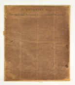
Mindestpreis nicht eingehalten Keine Abbildung Keine Abbildung Keine Abbildung Keine Abbildung Keine Abbildung Los 40 DECLARATION OF INDEPENDENCE. 20TH CENTURY FACSIMILE 40DECLARATION OF INDEPENDENCE. 20TH CENTURY FACSIMILE Auctioneum Ltd - East Bristol & Bath In Congress July 4, 1776. The unanimous Declaration of the thirteen United States of America. A 20th century - believed early to mid - facsimile d... Auf die Merkliste Timed
Mindestpreis nicht eingehalten Keine Abbildung Keine Abbildung Keine Abbildung Keine Abbildung Keine Abbildung Keine Abbildung Keine Abbildung Keine Abbildung Los 11 TWO MAPS OF THE UNITED KINGDOM, BEING ISLE OF ARRAN BY TIMOTHY PONT & DURHAM BY BLAEU 11TWO MAPS OF THE UNITED KINGDOM, BEING ISLE OF ARRAN BY TIMOTHY PONT & DURHAM BY BLAEU Auctioneum Ltd - East Bristol & Bath Maps:- two 17th century maps of the United Kingdom. Comprising a map of the Isle of Arran by Timothy Pont (arania Insula in aestuario Glottae Timo... Auf die Merkliste Timed
Mindestpreis nicht eingehalten Keine Abbildung Keine Abbildung Keine Abbildung Keine Abbildung Los 100 EGYPT. 1788 MAP OF EGYPT DRAWN FROM D ' ANVILLE'S ATLAS ENGR. J. HARRISON, UNFRAMED 100EGYPT. 1788 MAP OF EGYPT DRAWN FROM D ' ANVILLE'S ATLAS ENGR. J. HARRISON, UNFRAMED Auctioneum Ltd - East Bristol & Bath Map of Egypt. 1788 Egypt, called in the Language of the Country Missir; drawn from d' Anville's Atlas. Engraved for J. Harrison, No. 115 Newgate S... Auf die Merkliste Timed
Mindestpreis nicht eingehalten Keine Abbildung Keine Abbildung Keine Abbildung Keine Abbildung Keine Abbildung Los 130 SEA CHARTS. 1798 A CHART OF THE ENTRANCE OF THE RED SEA PUBL. LAURIE & WHITTLE 130SEA CHARTS. 1798 A CHART OF THE ENTRANCE OF THE RED SEA PUBL. LAURIE & WHITTLE Auctioneum Ltd - East Bristol & Bath Sea charts. 1798 A Chart of the Entrance of the Red Sea between the Coast of Arabia, ascertained by the Observations of Lieut. George Lewis in 176... Auf die Merkliste Timed
Mindestpreis nicht eingehalten Keine Abbildung Keine Abbildung Los 108 TWO MAPS OF PYEONGYANG Korea, Joseon period, 18th - 19th century (2) 108TWO MAPS OF PYEONGYANG Korea, Joseon period, 18th - 19th century (2) Bonhams TWO MAPS OF PYEONGYANG Korea, Joseon period, 18th - 19th century Ink and light color on paper, framed and glazed. 36 1/2 x 18 1/4in (92.7 x 46.4... Auf die Merkliste Timed
Mindestpreis nicht eingehalten Keine Abbildung Keine Abbildung Keine Abbildung Keine Abbildung Keine Abbildung Keine Abbildung Keine Abbildung Keine Abbildung Los 137 Johan Friedrich Leonhard Dreier (Trondheim 1775-1833 Bergen) Views of Norway: Trondheim from the... 137Johan Friedrich Leonhard Dreier (Trondheim 1775-1833 Bergen) Views of Norway: Trondheim from the... Bonhams Johan Friedrich Leonhard Dreier (Trondheim 1775-1833 Bergen) Views of Norway: Trondheim from the East; A prospect of Molde; and Bergen from the So... Auf die Merkliste Timed
Keine Abbildung Keine Abbildung Keine Abbildung Keine Abbildung Keine Abbildung Keine Abbildung Los 193 John Stockdale, 1805 Antique Hand-Colored Map of Kent, England 193John Stockdale, 1805 Antique Hand-Colored Map of Kent, England Lion and Unicorn Original hand-colored copperplate engraving titled A Map of Kent from the best Authorities, published by John Stockdale on March 26, 1805. Engrave... Auf die Merkliste Live
Mindestpreis nicht eingehalten Keine Abbildung Keine Abbildung Keine Abbildung Keine Abbildung Los 48 Johann Babtiste Homann (1664 - 1724, Nürnberg) - Landkarte Kaspisches Meer und Kamtschatka, um 1720 48Johann Babtiste Homann (1664 - 1724, Nürnberg) - Landkarte Kaspisches Meer und Kamtschatka, um 1720 Wersching Auktionen Johann Babtiste Homann (1664 - 1724, Nürnberg) - Landkarte Kaspisches Meer und Kamtschatka, um 1720Mare Caspium altera Kamtzadaliam seu Terram Jed... Auf die Merkliste Timed
Keine Abbildung Keine Abbildung Los 789 ASIA -- "MAGNI MOGOLIS IMPERIUM". Amst., P. Schenk & G. Valk, (c. 1700). Cold 789ASIA -- "MAGNI MOGOLIS IMPERIUM". Amst., P. Schenk & G. Valk, (c. 1700). Cold Burgersdijk & Niermans ASIA -- "MAGNI MOGOLIS IMPERIUM". Amst., P. Schenk & G. Valk, (c. 1700). Cold. engr. map w. 2 cartouches 365 x 485 mm. -- Added: "Tab. XIII. Asiae... Auf die Merkliste Live
Keine Abbildung Los 795 FRANCE -- "LE MAINE". (Amst., H. Hondius, 1633). Handcold. engr. map. 370 x 795FRANCE -- "LE MAINE". (Amst., H. Hondius, 1633). Handcold. engr. map. 370 x Burgersdijk & Niermans FRANCE -- "LE MAINE". (Amst., H. Hondius, 1633). Handcold. engr. map. 370 x 500 mm. (Lower margin split on fold, lower right corner faintly staine... Auf die Merkliste Live
Keine Abbildung Los 807 LOW COUNTRIES -- "PASKAERTE VAN HET INKOOMEN VAN DE MAES, Tot aen 't 807LOW COUNTRIES -- "PASKAERTE VAN HET INKOOMEN VAN DE MAES, Tot aen 't Burgersdijk & Niermans LOW COUNTRIES -- "PASKAERTE VAN HET INKOOMEN VAN DE MAES, Tot aen 't Eylandt Roosenburgh als mede 't Inkoomen van 't Goereesche gat, tot aen Oude ... Auf die Merkliste Live
Keine Abbildung Keine Abbildung Los 820 SOUTH AMERICA -- BRAZIL -- "URBS SALVADOR [DE BAHIA]". (Amst., 1671). Engr. view in 820SOUTH AMERICA -- BRAZIL -- "URBS SALVADOR [DE BAHIA]". (Amst., 1671). Engr. view in Burgersdijk & Niermans SOUTH AMERICA -- BRAZIL -- "URBS SALVADOR [DE BAHIA]". (Amst., 1671). Engr. view in bird's eye perspective. 290 x 365 mm. From Montanus 'De Nieuwe... Auf die Merkliste Live
Keine Abbildung Los 827 WEST INDIES -- "NIEUWE KAART van het Eyland St. Eustatius in derzelver Ligging 827WEST INDIES -- "NIEUWE KAART van het Eyland St. Eustatius in derzelver Ligging Burgersdijk & Niermans WEST INDIES -- "NIEUWE KAART van het Eyland St. Eustatius in derzelver Ligging & Plantagien met de Naamen der Bezitteren". Amst., R. Ottens, 1775.... Auf die Merkliste Live
Keine Abbildung Los 794 EUROPE -- "CARTE GÉNÉRALE DES ROUTES DES CHEMINS DE FER et des principales 794EUROPE -- "CARTE GÉNÉRALE DES ROUTES DES CHEMINS DE FER et des principales Burgersdijk & Niermans EUROPE -- "CARTE GÉNÉRALE DES ROUTES DES CHEMINS DE FER et des principales voies navigables de l'Europe". Paris, J. Andriveau-Goujon, 1850. Steel-... Auf die Merkliste Live
Keine Abbildung Los 810 LOW COUNTRIES -- "TABULA NOVA PROVINCIÆ ULTRAJECTINÆ". (Amst.), N. Visscher/P. Schenk, n.d 810LOW COUNTRIES -- "TABULA NOVA PROVINCIÆ ULTRAJECTINÆ". (Amst.), N. Visscher/P. Schenk, n.d Burgersdijk & Niermans LOW COUNTRIES -- "TABULA NOVA PROVINCIÆ ULTRAJECTINÆ". (Amst.), N. Visscher/P. Schenk, n.d. (c. 1700). Engr. map on 2 conjoined sheets after B. du... Auf die Merkliste Live
Keine Abbildung Keine Abbildung Keine Abbildung Keine Abbildung Los 472 MAPS -- "AVRUPA, ASYA ve AFRIKA (…)". (Istanbul?), State Printing Office Matbaa-i Amire 472MAPS -- "AVRUPA, ASYA ve AFRIKA (…)". (Istanbul?), State Printing Office Matbaa-i Amire Burgersdijk & Niermans MAPS -- "AVRUPA, ASYA ve AFRIKA (…)". (Istanbul?), State Printing Office Matbaa-i Amire, dated 1254 (=1838/1839). Printed map of the (Holy) Ottoma... Auf die Merkliste Live
Keine Abbildung Keine Abbildung Los 804 LOW COUNTRIES -- "KAART VAN DE RIVIER DE LEK met zyn uiterwaarden, noorder 804LOW COUNTRIES -- "KAART VAN DE RIVIER DE LEK met zyn uiterwaarden, noorder Burgersdijk & Niermans LOW COUNTRIES -- "KAART VAN DE RIVIER DE LEK met zyn uiterwaarden, noorder en zuider dyken, van de Merwede beneden Krimpen, tot het Schoor van Hag... Auf die Merkliste Live
Keine Abbildung Keine Abbildung Los 815 SOUTH AMERICA -- "A NEW AND ACCURATE MAP of Peru and the Country 815SOUTH AMERICA -- "A NEW AND ACCURATE MAP of Peru and the Country Burgersdijk & Niermans SOUTH AMERICA -- "A NEW AND ACCURATE MAP of Peru and the Country of the Amazones, drawn from the most authentick French maps &c. and regulated by ... Auf die Merkliste Live
Keine Abbildung Los 475 MAPS -- KIEPERT, H. "Specialkarte vom Westlichen Kleinasien". Berlin, Verlag von Dietrich Reimer 475MAPS -- KIEPERT, H. "Specialkarte vom Westlichen Kleinasien". Berlin, Verlag von Dietrich Reimer Burgersdijk & Niermans MAPS -- KIEPERT, H. "Specialkarte vom Westlichen Kleinasien". Berlin, Verlag von Dietrich Reimer, 1890. Lithogr. map in 16 sections and 1 overview... Auf die Merkliste Live
Keine Abbildung Los 796 GREAT BRITAIN -- "THE ISLE OF MAN (…). Described by Tho Durham Ano. 1595 796GREAT BRITAIN -- "THE ISLE OF MAN (…). Described by Tho Durham Ano. 1595 Burgersdijk & Niermans GREAT BRITAIN -- "THE ISLE OF MAN (…). Described by Tho Durham Ano. 1595". Lond., J. Speed, 1610. Cont. handcold. engr. map decorated w. ships and... Auf die Merkliste Live
Keine Abbildung Keine Abbildung Los 817 SOUTH AMERICA -- "AMERICA MERIDIONALIS". (Amst., J. Hondius, 1619). Engr. map of South 817SOUTH AMERICA -- "AMERICA MERIDIONALIS". (Amst., J. Hondius, 1619). Engr. map of South Burgersdijk & Niermans SOUTH AMERICA -- "AMERICA MERIDIONALIS". (Amst., J. Hondius, 1619). Engr. map of South-America, cold. by hand, w. inset view of Cusco. 364 x 498 m... Auf die Merkliste Live
Keine Abbildung Keine Abbildung Keine Abbildung Los 806 LOW COUNTRIES -- LEIDEN -- "LUGDUNUM BATAVORUM". (Leiden), 1675. Engraved plan of the city 806LOW COUNTRIES -- LEIDEN -- "LUGDUNUM BATAVORUM". (Leiden), 1675. Engraved plan of the city Burgersdijk & Niermans LOW COUNTRIES -- LEIDEN -- "LUGDUNUM BATAVORUM". (Leiden), 1675. Engraved plan of the city by C. Hagen on 3 loose sheets: I. City map in bird's-ey... Auf die Merkliste Live
Keine Abbildung Los 797 LOW COUNTRIES -- "AMSTERDAM". (Frankfurt a/M., M. Merian, c. 1659). Engr. profile 797LOW COUNTRIES -- "AMSTERDAM". (Frankfurt a/M., M. Merian, c. 1659). Engr. profile Burgersdijk & Niermans LOW COUNTRIES -- "AMSTERDAM". (Frankfurt a/M., M. Merian, c. 1659). Engr. profile view of the city on 2 conjoined plates, w. 2 coats of arms and w... Auf die Merkliste Live
Keine Abbildung Los 801 LOW COUNTRIES -- BREDA -- "ARTILLERIE CAMP BY BREDA 1769". 's-Grav., I. du 801LOW COUNTRIES -- BREDA -- "ARTILLERIE CAMP BY BREDA 1769". 's-Grav., I. du Burgersdijk & Niermans LOW COUNTRIES -- BREDA -- "ARTILLERIE CAMP BY BREDA 1769". 's-Grav., I. du Mee, n.d. (c. 1769). Broadside, consisting of engr. in 2 parts dep. mil... Auf die Merkliste Live
Keine Abbildung Keine Abbildung Los 828 WEST INDIES -- "NIEUWE PASCAERT VAN WESTINDIEN de Vaste Kusten en de Eylanden 828WEST INDIES -- "NIEUWE PASCAERT VAN WESTINDIEN de Vaste Kusten en de Eylanden Burgersdijk & Niermans WEST INDIES -- "NIEUWE PASCAERT VAN WESTINDIEN de Vaste Kusten en de Eylanden". Amst., H. Doncker, n.d. (c. 1705). Engr. chart of the West Indies ... Auf die Merkliste Live


![SOUTH AMERICA -- BRAZIL -- "URBS SALVADOR [DE BAHIA]". (Amst., 1671). Engr. view in](https://portal-images.azureedge.net/auctions-2025/burger10011/images/15f34e3b-6147-4b2c-aa54-b2b100ef2806.jpg?h=175)


