Verfeinern Sie Ihre Suche
- Liste
- Galerie
-
232 Los(e)/Seite
Ein Abonnement der Preisliste ist notwendig um Ergebnisse, von Auktionen die vor einem längeren Zeitraum als 10 Tagen stattgefunden haben, ansehen zu können. Klicken Sie hier für mehr Informationen
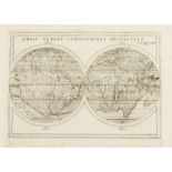
World.- Münster (Sebastian) La Figure du Monde Universel, Munster's world map for the 1550 edition of Cosmographia by David Kandel, oval projectio...
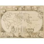
World.- Mercator (Rumold) Orbis Terrae Compendiosa Descriptio, [circa 1587 but slightly later].
World.- Mercator (Rumold) Orbis Terrae Compendiosa Descriptio, highly decorative world map, a condensed version of Rumold's father's world map of ...
World.- Quad (Matthias) Typus orbis terrarum ad imitationem universalis gerhardi Mercatoris..., …
World.- Quad (Matthias) Typus orbis terrarum ad imitationem universalis gerhardi Mercatoris..., early map of the World derived from Mercator's pla...
World.- Genesis flood.- Moxon (Joseph) A Map of all the Earth and how after the flood it was …
World.- Genesis flood.- Moxon (Joseph) A Map of all the Earth and how after the flood it was divided among the sons of Noah, map of the World, wit...
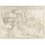
World.- Alexander the Great.- De L'Isle (Guillaume) Alexandri Magni Imperium et Expeditio, 1731; …
World.- Alexander the Great.- De L'Isle (Guillaume) Alexandri Magni Imperium et Expeditio, large map illustrating Alexander the Great's conquests ...
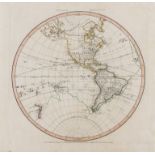
World.- Capt. James Cook.- Jefferys (Thomas) Western Hemisphere; Eastern Hemisphere, a pair, …
World.- Capt. James Cook.- Jefferys (Thomas) Western Hemisphere; Eastern Hemisphere, a pair of hemisphere world maps showing the first voyage of C...
World.- Southern Hemisphere.- Capt. James Cook.- Kaart Van Het Zuider Halfrond, 1795; together …
World.- Southern Hemisphere.- Capt. James Cook.- Kaart Van Het Zuider Halfrond, Dutch version of a map recording historic and recent voyages in th...
World.- Needlework.- Anonymous (1800) A Map of the World, According to the Latest Discoveries, 1800.
World.- Embroidered Map.- Anonymous (1800) A Map of the World, According to the Latest Discoveries, double-hemisphere world map with vignettes in ...
World.- Capt. James Cook.- Russell (John) Map of the World Shewing the Tracks & Discoveries of …
World.- Capt. James Cook.- Russell (John) Map of the World Shewing the Tracks & Discoveries of Capt. Cook, double-hemisphere world map, engraving ...
World.- Homann Heirs. Die Erde in Zwey Halbkugeln, double-hemisphere world map, engraving with hand-colouring, platemark 430 x 610 mm. (17 x 24 in...
World.- Norie (John William) To the Officers in the Honorable East India Company's Service This …
World.- Norie (John William) To the Officers in the Honorable East India Company's Service This Outline Chart Intended for their Use to prick-off ...
World.- Weimar Geographisches Institut. Westlicher Planiglob Der Erder; Oestlicher Planiglob, Der …
World.- Weimar Geographisches Institut. Westlicher Planiglob Der Erder; Oestlicher Planiglob, Der Erde, a pair of large world maps showing the Ea...
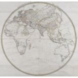
World.- Russia.- [Cyrillic - Double Hemisphere World Map], large wall map of the world centred on Russia and showing both Polar regions, with deco...
World.- Teesdale (Henry) A New Chart of the World on Mercator's Projection with the Tracks of the …
World.- Teesdale & Co. (Henry, publisher) A New Chart of the World on Mercator's Projection with the Tracks of the Most Celebrated Recent Navigato...
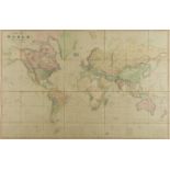
World.- Marmocchi (Francesco Costantino) Geografia Delle Piante, world map with geological views of five mountains above, and with other additiona...
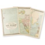
World.- Bartholomew & Son Ltd. (John) Bartholomew's Library Chart of the World on Mercator's …
World.- Bartholomew & Son Ltd. (John) Bartholomew's Library Chart of the World on Mercator's Projection, large map of the World on eight folding s...
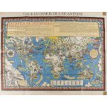
World.- Gill (MacDonald) Carte de la Charte de L'Antique, French edition of Gill's scarce pictorial "Time and Tide" Map of The Atlantic Charter, w...
Africa.- Fries (Lorenz) Tabula II Aphricae, Ptolemaic map of the central part of the North African Coastline, with islands in the Mediterranean, b...
Africa.- Fries (Lorenz) Libyae Interioris Pars, Ptolemaic map showing eastern Libya, Egypt and the Nile Delta, based upon the work of Waldseemulle...
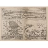
Africa.- Pirates.- Braun (Georg) and Franz Hogenberg. Tunes, Oppidum Barbarie & Regia Sedes... [on …
Africa.- Pirates.- Braun (Georg) and Franz Hogenberg. Tunes, Oppidum Barbarie & Regia Sedes... [on sheet with] Africa, olim Aphrodisium [and] Peno...
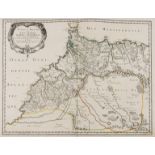
Africa.- Morocco.- Sanson (Nicolas) & Pierre Marriette. Estats et Royaumes de Fez et Maroc; Darha …
Africa.- Morocco.- Sanson (Nicolas) & Pierre Marriette. Estats et Royaumes de Fez et Maroc; Darha et Segelmesse; tires de Sanuto de Marmol &c., m...
Africa.- Speed (John) Africae, described the manners of their habits, and buildinge..., [1665].
Africa.- Speed (John) Africae, described the manners of their habits, and buildinge..., the first map of Africa prepared by an English cartographe...
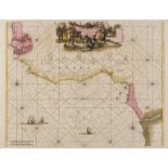
Africa.- Guinea.- Wit (Frederik de) Tractus Littorales Guineae a Promontorio Verde Usque ad Sinum …
Africa.- Guinea.- Wit (Frederik de) Tractus Littorales Guineae a Promontorio Verde Usque ad Sinum Catenbelae, sea chart of the Coast of Guinea, sh...
Africa.- Jansson (Jan) Regna Congo et Angola, engraving with original hand-colouring, on laid paper without watermark, platemark 412 x 500 mm. (16...
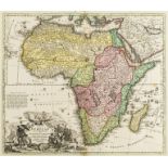
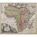
Africa.- Homann (Johann Baptist) Totius Africae Nova Repraesentatio qua Praeter Diversos in ea …
Africa.- Homann (Johann Baptist) Totius Africae Nova Repraesentatio qua Praeter Diversos in ea Status et Regiones, Etiam Origo Nili..., large map...
Africa.- Seutter (Matthäus) Africa Iuxta Navigationes et Observationes Recentissimas Aucta Correcta et in sua Regna et Status Divisa, in Lucem Edi...
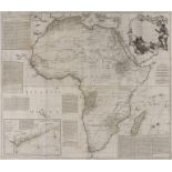
Africa.- Sayer (Robert) Africa According to Mr. D'Anville with Several Additions and Improvements, …
Africa.- Sayer (Robert) Africa According to Mr. D'Anville with Several Additions and Improvements, large wall map with inset chart of the Gold Coa...
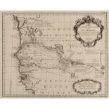
Africa.- Senegal.- De L'Isle (Guillaume) Carte de l'Afrique Francoise ou du Senegal Dressee sur un …
Africa.- Senegal.- De L'Isle (Guillaume) Carte de l'Afrique Francoise ou du Senegal Dressee sur un Grand Nombre de Cartes Manuscrites et d'Itinera...
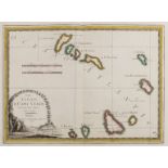
Africa.- Cape Verde.- Cassini (Giovanni Maria) Le Isole Di Capo Verde, the Cape Verde islands with decorative title cartouche in the lower left co...
Africa.- Napoleon.- Denon (V.) Plan De La Bataille D'Aboukir, Le 27 Juillet 1799, scarce general plan of the Battle of Aboukir showing the events ...
Americas.- Bertius (Petrus) Carte de L'Amerique corrige‚ augmentee; dessus toutes les aultres cy …
Americas.- Bertius (Petrus) Carte de L'Amerique corrige‚ augmentee; dessus toutes les aultres cy devant..., map other Americas based on Hondius`s ...
Americas.- Leth (Hendrik de) Le Nouveau Continent ou l'Amerique Divisee en Septentrionale et …
Americas.- Leth (Hendrik de) Le Nouveau Continent ou l'Amerique Divisee en Septentrionale et Meridionale..., map of North and South America which ...
Americas.- Bellin (Jacques Nicolas) Carte Reduite des Costes Orientales de l'Amérique Septentrionale, sea chart of northeast North America, showin...
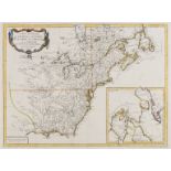
America & Canada.- Santini (Francois) Carte Generale du Canada, de la Louisiane, de la Floride, de …
America & Canada.- Santini (Francois) Carte Generale du Canada, de la Louisiane, de la Floride, de la Caroline, de la Virginie, de la Nouvelle Ang...
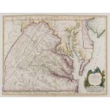
Americas.- Vaugondy (Gilles Robert de) Carte de la Virginie et du Maryland Dressée sur la Grande …
Americas.- Vaugondy (Gilles Robert de) Carte de la Virginie et du Maryland Dressée sur la Grande Carte Angloise de Mrs. Josué Fry et Pierre Jeffer...
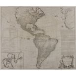
Americas.- Sayer (Robert) A Map of the Whole Continent of America divided into North and South and …
Americas.- Sayer (Robert) A Map of the Whole Continent of America divided into North and South and West Indies with a copious table, large wall ma...
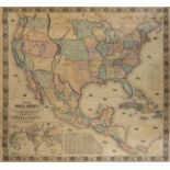
Americas.- Monk (Jacob) New Map of the Portion of North America, Exhibiting the United States and …
Americas.- Monk (Jacob) New Map of the Portion of North America, Exhibiting the United States and Territories, The Canadas, New Brunswick, Nova Sc...
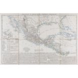
Cental America.- Mexico.- Marzolla (Benedetto) Messico e Stati dell'America Centrale, map of Mexico, covering Guatemala, Nicaragua, and Costa Rica...
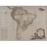
South America.- Cloppenburg (Johannes) America Meridionalis, from the rare edition of "Atlas Minor", a larger format edition of Mercator's pocket ...
South America.- Coronelli (Vincenzo Maria) [America Meridionale Auttore...], one sheet only (of two), showing the Western coast of South America f...
South America.- Sayer (Robert) A Map of South America Containing Tierra-Firma, Guayana, New …
South America.- Sayer (Robert) A Map of South America Containing Tierra-Firma, Guayana, New Granada Amazonia, Brasil, Peru, Paraguay, Chaco, Tucum...
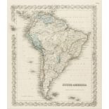
South America.- A good group of 27 maps of South America, mainly 18th and 18th century; and two …
South America.- A good group of 27 maps of South America, including maps by Moll, Bonne, Bellin, Tallis, John Colton & Co., and others, engravings...
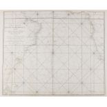
South Atlantic Ocean.- Bellin (Jacques Nicolas) Carte reduite de l'Ocean meridional..., 1739.
South Atlantic Ocean.- Bellin (Jacques Nicolas) Carte reduite de l'Ocean meridional..., map of South America, South Africa and the Southern Atlant...
Americas.- Mexico.- Dufour (Auguste-Henri) Mexique Antilles, Etats-Unis, French map depicting the United States, Mexico, Central America, and the ...
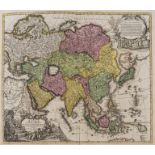
Asia.- Homann (Johann Baptist) Asiae Recentissima Delineatio, qua Status et Imperia Totius Orientis una cum Orientalibus Indiis..., map of Asia sh...
Asia.- Danet (Guillaume) L'Asie Dressee sur de Nouveaux Memoires Assujetis aux Observations …
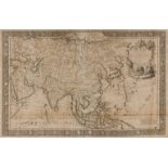
Asia.- Danet (Guillaume) L'Asie Dressee sur de Nouveaux Memoires Assujetis aux Observations Astronomiq..., map of Asia set within decorative borde...
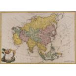
Asia.- Brion de la Tour (Louis) L'Asie, large detailed map showing from the Arabian Peninsula to New Guinea and part of Australia, including India...
East Indies.- Jansson (Jan) Sumatrae et Insularum Locorumque Nonnullorum Circumiacentium Tabula …
East Indies.- Jansson (Jan) Sumatrae et Insularum Locorumque Nonnullorum Circumiacentium Tabula Nova, map of Sumatra with north oriented to the le...
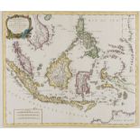
South East Asia.- Santini (Francois) Archipel des Indes Orientales, qui Comprend les Isles de la …
South East Asia.- Santini (Francois) Archipel des Indes Orientales, qui Comprend les Isles de la Sonde, Moluques et Philippines..., detailed map a...
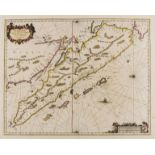
China.- Blaeu (Willem Jansz. and Johannes) China Veteribus Sinarum Regio, map of China, Korea and Japan, with decorative cartouche in the upper ri...
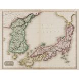
Japan & Korea.- Pinkerton (John) Japan, detailed map of Japan and Korea, from Pinkerton's "Modern Atlas", engraving with original hand-colouring o...
Australasia & East Indies.- Coronelli (Vincenzo Maria) Nuova Guinea, globe gore showing Northern Australia and the East Indies, with Northern Aust...
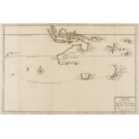
Australasia.- Discovery of Tasmania and New Zealand.- Valentyn (Francois) Kaart der Reyse van Abel …
Australasia.- Discovery of Tasmania and New Zealand.- Valentyn (Francois) Kaart der Reyse van Abel Tasman, map detailing the routes taken by Abel ...
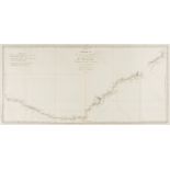
Australasia.- Capt. James Cook.- , Carte de la Nle. Galles Meridle. ou de la Cote Orientale de la …
Australasia.- Capt. James Cook.- Carte de la Nle. Galles Meridle. ou de la Cote Orientale de la Nle. Hollande Decouverte et Visitee par le Lieuten...
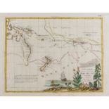
Australasia.- Capt. James Cook.- Zatta (Antonio) Nuove Scoperte Fatte nel 1765. 67. e 69 nel Mare …
Australasia.- Capt. James Cook.- Zatta (Antonio) Nuove Scoperte Fatte nel 1765. 67. e 69 nel Mare del Sud, early record of Capt. Cook's discoverie...
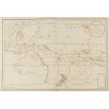
Australasia.- Capt. James Cook.- Djurberg (Daniel) Polynesien (Inselwelt) oder der Funfte Welttheil..., chart of the Western Pacific, Polynesia an...
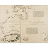
Australia.- Bowen (Emanuel) A complete map of the southern continent, survey'd by Capt. Abel …
Australia.- Bowen (Emanuel) A complete map of the southern continent, survey'd by Capt. Abel Tasman & depicted by order of the East India Company ...
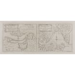
Australia.- Capt. James Cook.- Entrance of Endeavour River, in New South Wales; Botany Bay, in New …
Australia.- Capt. James Cook.- Entrance of Endeavour River, in New South Wales/ Botany Bay, in New South Wales, two maps on one sheet, engraved by...
Australia.- Lauvergne (Barthelemy), after. Sydney Etablissement Principal de la Nouvelle Galles du …
Australia.- Lauvergne (Barthelemy), after. Sydney Etablissement Principal de la Nouvelle Galles du Sud, view showing Sydney harbour and a rowing b...
Australia & New Zealand.- Sea Charts.- Imray & Son (James) Western Pacific [Chart No. 1], 1875; …
Australia & New Zealand.- Sea Charts.- Imray & Son (James) Western Pacific [Chart No. 1], large sea chart including New Zealand, with several deta...
-
232 Los(e)/Seite


![World.- Münster (Sebastian) La Figure du Monde Universel, [c. 1552-68].](https://portal-images.azureedge.net/auctions-2019/forum-10193/images/000e5f00-4a0f-4f02-a6a3-ab12009d8c37.jpg?w=155&h=155)

![World.- Mercator (Rumold) Orbis Terrae Compendiosa Descriptio, [circa 1587 but slightly later].](https://portal-images.azureedge.net/auctions-2019/forum-10193/images/4ce69d74-24fc-4b35-bcf0-ab12009d29ea.jpg?w=155&h=155)
![World.- Homann Heirs. Die Erde in Zwey Halbkugeln, [c. 1813-1830].](https://portal-images.azureedge.net/auctions-2019/forum-10193/images/5bfd2019-a8ef-40c0-ba83-ab12009d1e5a.jpg?w=155&h=155)
![World.- Russia.- [Cyrillic - Double Hemisphere World Map], 1838.](https://portal-images.azureedge.net/auctions-2019/forum-10193/images/f074b55a-48a2-4b95-973d-ab12009d0788.jpg?w=155&h=155)
![World.- Marmocchi (Francesco Costantino) Geografia Delle Piante, [c. 1850-1855].](https://portal-images.azureedge.net/auctions-2019/forum-10193/images/22c9487f-1f10-49c2-81e3-ab12009d3fe7.jpg?w=155&h=155)
![Africa.- Fries (Lorenz) Tabula II Aphricae, [c. 1522-1535].](https://portal-images.azureedge.net/auctions-2019/forum-10193/images/68a9921b-73ec-471d-a278-ab12009dabbf.jpg?w=155&h=155)
![Africa.- Fries (Lorenz) Libyae Interioris Pars, [c. 1522-1535].](https://portal-images.azureedge.net/auctions-2019/forum-10193/images/25d20adb-9610-484c-ac96-ab12009d97ad.jpg?w=155&h=155)
![Africa.- Speed (John) Africae, described the manners of their habits, and buildinge..., [1665].](https://portal-images.azureedge.net/auctions-2019/forum-10193/images/3fe06501-33ef-4dd2-816d-ab12009cfc98.jpg?w=155&h=155)
![Africa.- Jansson (Jan) Regna Congo et Angola, [c. 1660-1700].](https://portal-images.azureedge.net/auctions-2019/forum-10193/images/f3d4b5ad-583c-45ca-965e-ab12009cfa9b.jpg?w=155&h=155)
![South America.- Cloppenburg (Johannes) America Meridionalis, [1630].](https://portal-images.azureedge.net/auctions-2019/forum-10193/images/a6adeb24-f1b4-4088-bad3-ab12009cf213.jpg?w=155&h=155)
![South America.- Coronelli (Vincenzo Maria) [America Meridionale Auttore...], [c. 1690].](https://portal-images.azureedge.net/auctions-2019/forum-10193/images/a797ab3e-e9e2-4317-97d7-ab12009de1e8.jpg?w=155&h=155)
![Mexico.- Dufour (Auguste-Henri) Mexique Antilles, Etats-Unis, [1868].](https://portal-images.azureedge.net/auctions-2019/forum-10193/images/5d0544bb-1557-4a7e-81aa-ab12009da4f6.jpg?w=155&h=155)
![China.- Blaeu (Willem Jansz. and Johannes) China Veteribus Sinarum Regio, [c. 1640].](https://portal-images.azureedge.net/auctions-2019/forum-10193/images/3dd6fa2c-fd0b-48a3-a568-ab12009dc9b8.jpg?w=155&h=155)
![Australasia & East Indies.- Coronelli (Vincenzo Maria) Nuova Guinea, [c. 1696].](https://portal-images.azureedge.net/auctions-2019/forum-10193/images/b1ffd8e4-8d3d-479a-982f-ab12009d0c18.jpg?w=155&h=155)
![Australia & New Zealand.- Sea Charts.- Imray & Son (James) Western Pacific [Chart No. 1], 1875; …](https://portal-images.azureedge.net/auctions-2019/forum-10193/images/97fe1c1f-8eef-4576-b2cd-ab12009d9e56.jpg?w=155&h=155)