Sortieren nach:
- Kategorie
- Liste
- Galerie
-
7 Los(e)/Seite
Dieses Auktionshaus möchte seine Ergebnisse nicht veröffentlichen. Bitte kontaktieren Sie das Auktionshaus bei Fragen direkt.
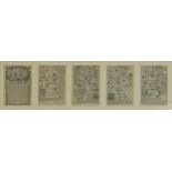

The Road from London to Newhaven and The Road from London to Land's End Cornwall, set of four 18th
The Road from London to Newhaven and The Road from London to Land's End Cornwall, set of four 18th century roadmaps mounted, framed and glazed as ...
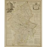
An Improved Map of the County of Stafford, hand coloured antique map by Emmanuel Bowen, The Graves
An Improved Map of the County of Stafford, hand coloured antique map by Emmanuel Bowen, The Graves Gallery label verso, framed and glazed, 73cm x ...
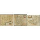
Three Robert Morden antique hand coloured maps comprising Herefordshire, Somersetshire and Middlesex, each mounted, framed and glazed, the largest...
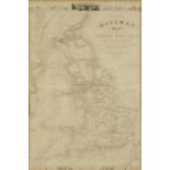
Tallis's Railway Map of Great Britain, mounted, framed and glazed, 55cm x 36cm excluding the mount
Tallis's Railway Map of Great Britain, mounted, framed and glazed, 55cm x 36cm excluding the mount and frame
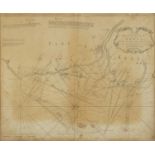
A Large Chart of the Downs, antique map sold by Mount & Page, Tower Hill, London, framed and glazed,
A Large Chart of the Downs, antique map sold by Mount & Page, Tower Hill, London, framed and glazed, 59cm x 48.5cm excluding the frame ...[more]
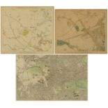
Three 19th century and later maps of London including Stanford's Library Map of London and it's
Three 19th century and later maps of London including Stanford's Library Map of London and it's Suburbs published by Edward Stanford, February 15t...
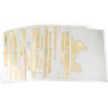
Large collection of local interest depth charts including Portland Harbour
-
7 Los(e)/Seite