Verfeinern Sie Ihre Suche
Sortieren nach:
- Kategorie
- Liste
- Galerie
-
7 Los(e)/Seite
Ein Abonnement der Preisliste ist notwendig um Ergebnisse, von Auktionen die vor einem längeren Zeitraum als 10 Tagen stattgefunden haben, ansehen zu können. Klicken Sie hier für mehr Informationen
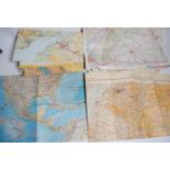

A large collection of maps to include Ordnance surver Carmarthenshire and other surrounding areas.
A large collection of maps to include Ordnance surver Carmarthenshire and other surrounding areas. Also hand held Ordnance survey and similar all ...
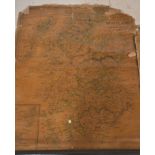
A collection of vintage roll up maps dating from the 19th and early 20th century to include a map of Bridgewater Bay, Somerset. Also, Cruchleys ma...
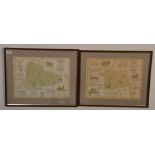
Local Interest - Two framed and glazed antique style maps to include a map of Pucklechurch 1844
Local Interest - Two framed and glazed antique style maps to include a map of Pucklechurch 1844 and the other of Bitton 1843. Both measure 49cm ta...
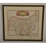
Robert Morden – an 18th century engraved and hand coloured map of Suffolk. Framed and glazed.
Robert Morden – an 18th century engraved and hand coloured map of Suffolk. Framed and glazed. Measures 36cm tall by 42cm wide. ...[more]
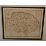
John Cary – an early 19th century hand coloured map of Norfolk, by ‘J. Cary’. Framed. Measures
John Cary – an early 19th century hand coloured map of Norfolk, by ‘J. Cary’. Framed. Measures 40cm tall by 50cm wide. ...[more]
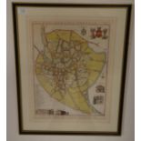
Sir Roger Kerrison – a 19th century engraved map of Norwich ‘Plan Of The City Of Norwich’. Signed ‘
Sir Roger Kerrison – a 19th century engraved map of Norwich ‘Plan Of The City Of Norwich’. Signed ‘Roger Kerrison’. Framed and glazed. Measures 46...
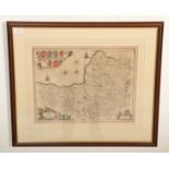
Johannes Blaeu (1599-1673) ‘Somerset Tensis – Somerset Shire’ – 17th century engraved and hand
Johannes Blaeu (1599-1673) ‘Somerset Tensis – Somerset Shire’ – 17th century engraved and hand coloured map of Somerset. Framed. Measures 51cm tal...
-
7 Los(e)/Seite