Sortieren nach:
- Nur Lose mit Abbildungen,
- Kategorie
- Liste
- Galerie
-
11 Los(e)/Seite
Ein Abonnement der Preisliste ist notwendig um Ergebnisse, von Auktionen die vor einem längeren Zeitraum als 10 Tagen stattgefunden haben, ansehen zu können. Klicken Sie hier für mehr Informationen
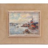

Evert Moll (1878-1955)Harbor view with many ships, panel 20x26 cm
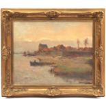
Johannes Embrosius van de Wetering de Rooij (1877-1972)View of the city by the river, canvas 40x50 cm
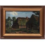
Arnold Hendrik Koning (1860-1945)View of barnyard with chicken, board 18.5x28 cm
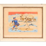
Odd Harrong (1913-1981)
Odd Harrong (1913-1981)Pa de hvite vidder (on the white plain), sex fargetrykk (6 color print), 32/300, 30x44 cm, outer size 56x69 cm
Topographic map
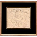
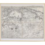
Topographic map, New map of the Meiery van 's Hertogenbosch, 29x33 cm
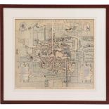
Framed and colored copper engraving of The Hague, titled Haga-Comitis in Hollandia 1570, Aenwysinge van s' Hage, as it was anno 1570, by cartograp...
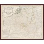
Topographical colored Carte Des Pays Bas Catholiques, par Guillaumede l'Isle, 18th century52x63 cm
Topographical colored map of Groningae et Omlandiae Dominium vulgo The Province of Stadt En Lande, 17th century 46x56 cm
Topographic map Image
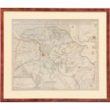
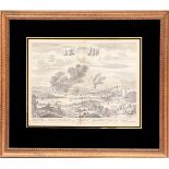
Topographic map Image of the City and Region of Rochester Chattam, Admiral de Ruiter, 27x35 cm
Topographic map in frame
Topographic map in frame, carrier is textile, Carte private des environs de Breda Geetrudenberg Dort Gorcum Heusden et Bommel, 43x57 cm
Topographical map in frame
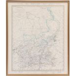
Topographical map in frame, Atlas du royaume des Pays Bas, Limbourg en arrondissemens et cantons de justice de paix, outer size 62x52 cm
-
11 Los(e)/Seite