247
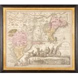
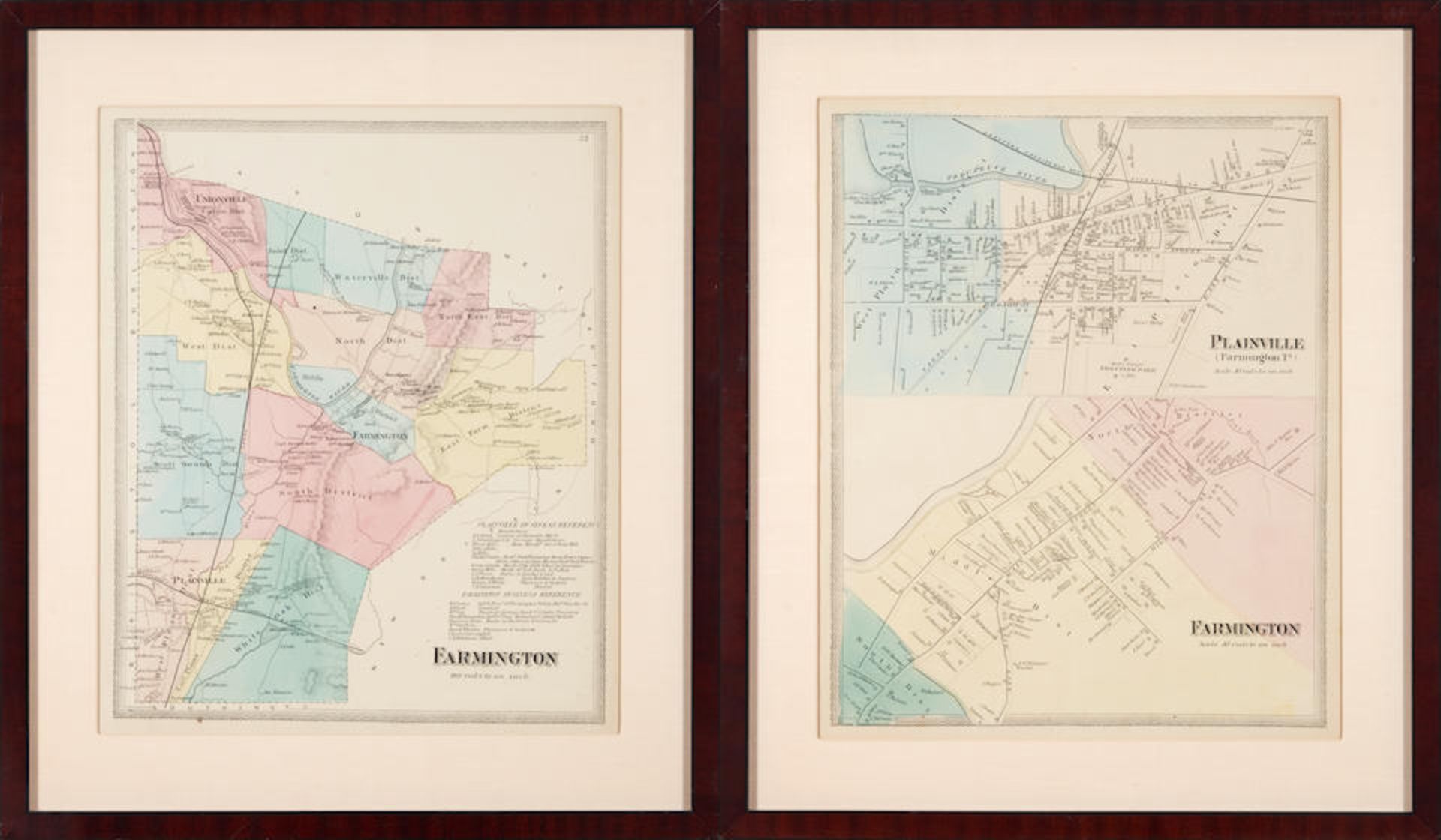
CONNECTICUT AREA MAPS. A group of two maps of Farmington and Plainville, from Atlas of Hartford ...

Das Auktionshaus hat für dieses Los keine Ergebnisse veröffentlicht
Marlborough, Massachusetts
Beschreibung
CONNECTICUT AREA MAPS. A group of two maps of Farmington and Plainville, from Atlas of Hartford and Tolland Counties, Connecticut, F.W. Beers, 1869. 1. Double map (2 maps printed on 1 sheet) of Plainsville and Farmington, CT, partially colored by hand, showing the Pequabuck River and Farmington River, boundaries of business districts, railroads, etc. 2. Map of Farmington and adjacent towns, with hand-colored business districts. Both approximately 380 x 455 mm. Light age spotting. Matted and framed; not examined out of frame. Footnotes: Provenance The collection of Eric van Rooy. Lot to be sold without reserve. For further information on this lot please visit Bonhams.com For further information about this lot please visit the lot listing
Auktionsdetails
Versand
AGB & Wichtige Informationen
Stellen Sie dem Verkäufer eine Frage
CONNECTICUT AREA MAPS. A group of two maps of Farmington and Plainville, from Atlas of Hartford and Tolland Counties, Connecticut, F.W. Beers, 1869. 1. Double map (2 maps printed on 1 sheet) of Plainsville and Farmington, CT, partially colored by hand, showing the Pequabuck River and Farmington River, boundaries of business districts, railroads, etc. 2. Map of Farmington and adjacent towns, with hand-colored business districts. Both approximately 380 x 455 mm. Light age spotting. Matted and framed; not examined out of frame. Footnotes: Provenance The collection of Eric van Rooy. Lot to be sold without reserve. For further information on this lot please visit Bonhams.com For further information about this lot please visit the lot listing
The Eric van Rooy Estate: A Connecticut Gentleman'
Endet ab
Ort der Versteigerung
274 Cedar Hill St
Marlborough
Massachusetts
01752
United States
...
Wichtige Informationen
This auction is now finished. If you are interested in consigning in future auctions, please contact the specialist department. If you have queries about lots purchased in this auction, please contact client services.
You are advised to visit www.bonhams.com for any additional information regarding auction 29673 which may have come to light for any Lot after producing the catalogue, which will be included in a "Sale Room Notice" accompanying each Lot.
AGB
https://www.bonhams.com/legals/
Vollständige AGBs